Prešov Region
| Seat: | Prešov |
| Area: | 8,974.5 km² |
| Population: | 798,596 |
| Density: | 89 /km² |
| Districts: | 13 |
Prešov region is situated in the northern part of eastern Slovakia and is covering historical parts such as Šariš, northern part of Spiš and a part of Zemplín. In the easter and north, Prešov region is bordering with Ukrayine and Poand. Prešov region is divided into 13 districst: Prešov, Bardejov, Sabinov, Stará Ľubovňa, Kežmarok, Poprad, Vranov nad Topľou, Stropkov, Svidník, Humenné, Medzilaborce a Snina.
Natural Conditions of Prešov Region
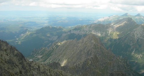
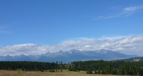
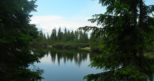
Prešov District has quite rugged terrain characterised by a complex geological structure. The region is mostly covered by brown forest soils overgrowth by beech forests. Great part of its territory is formed by Ondavská and Laborecká uplands. Vihorlat and Slánske Mountains have volcanic origin. High Tatras, Belianske Tatras and Kozie Chrbty Mountains extend on the West, Branisko lies on the North. Flysch mountain ranges lying on the North are separated from Slovak Ore Mountains on the South by Podtatranská and Hornádska basins. Spišská Magura, Levočské Mountains and Bachureň extend on the East; Eastern Beskydy mountain range is represented by Pieniny, Čergov and Ľubovnianska Upland. Prešov District falls into the temperate climate zone. There are many rivers flowing through the region. Torysa, Ondava, Topľa and Laborec rivers drain the central and eastern parts of the territory, Dunajec and Poprad rivers drain the northern and western ones. Domaša Dam on Ondava River and Stariná Dam on Cirocha River have an important economic contribution on the region. Prešov District is also rich in mineral waters. The best known are Bardejov with its alkalic water springs and Vyšné Ružbachy with acidulous earthy water. They are popular spa destinations. Three national parks reach into the Prešov District: TANAP, Pieniny and Poloniny national parks.
Prešov Region is divided into 13 districst
- Prešov
- Bardejov
- Sabinov
- Stará Ľubovňa
- Kežmarok
- Poprad
- Vranov nad Topľou
- Stropkov
- Svidník
- Humenné
- Medzilaborce
- Snina