Geography of Slovakia
Slovak Republic is a central European country with vast forest areas extending on two fifths of its territory. Its total area of 18,932 sq mi (49,035 sq km) does not rank Slovakia among large countries. Slovakian westernmost and easternmost points are separated only by 266.5 mi (429 km). Slovak Republic is bordered on the north by Poland; on the south by Hungary; on the west by Czech Republic and its eastern border is formed by Ukraine.
Slovakia’s northernmost point is situated nearby Babia Hora, located in today’s cadastral territory of Oravská Polhora. The southernmost point of Slovakia is situated on the Danube River close to a city called Patince. The easternmost point is situated on the Morava River in Záhorská Ves and the westernmost one nearby Nová Sedlica.
Located about 373 mi (600km) on the south-east, an Adriatic Sea is the nearest sea to the landlocked Slovakia. Slovakian surface is very irregular, characterized by lowlands, valleys, hills, highlands and mountain chains.
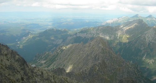
The lowest point of Slovakia lies on a place where the Bodrog River crosses the border with Hungary, at 308 ft (94m) above sea level. The highest point lies in the High Tatras on Gerlachovský Peak at 8,710ft (2,655m) above seal level.
The south and the south-east of the country are covered mostly by lowlands: Eastern Slovak Lowland, Záhorská Lowland and Danubian Lowland which is the most fertile and famous one.
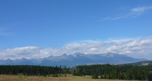
A great part of the Slovak territory is covered by protected landscape areas. Slovak topography is dominated by the Carpathian Mountains. Their well known mountain chains are: Slovak Ore Mountains; volcanic Štiavnica Mountains; Low Tatras, Greater Fatra and Lesser Fatra.
High Tatras is the most famous Slovakia mountain and it is the only mountain range with an Alpine character on the Slovak territory.
The largest cities of Slovakia
Kosice - 240,915 inhabitants
Presov - 92,687 inhabitants
Nitra - 87,357 inhabitants
Zilina - 86,685 inhabitants
Banska Bystrica - 84,919 inhabitants
Trnava - 70,191 inhabitants
Martin - 60,772 inhabitants
Trencin - 58,872 inhabitants
Poprad - 55,037 inhabitants
Prievidza - 54,405 inhabitants
Zvolen - 44,328 inhabitants
Records of Slovakia
| Highest Mountain in Slovakia | Gerlachovsky stit peak 2,655 m above sea level (High Tatras) |
|---|---|
| Lowest point in Slovakia | Klin nad Bodrogom - 94 m above sea level |
| Deepest Cave in Slovakia | Stary Hrad Cave - 432 m |
| Largest River in Slovakia | Vah River - 406 km |
| Smallest town of Slovakia | Modry Kamen - 1,414 inhabitants (district of Velky Krtis) |
| Largest village of Slovakia | Smižany - 8,153 inhabitatnts (district of Spisska Nova Ves) |
| Smallest village of Slovakia | Prikra - 10 inhabitants (district of Svidnik) |
| Westernmost village in Slovakia | Záhorská Ves 16°50' východnej dĺžky (okres Malacky) |
| Easternmost village in Slovakia | Nova Sedlica 22° 34' eastern longitude (district of Snina) |
| Southernmost village in Slovakia | Patince - 47° 44' eastern longitude (district of Komarno) |
| Northernmost village in Slovakia | Oravska Polhora - 49° 37' eastern longitude (district of Namestovo) |