Žilina
| Region | Žilina region |
|---|---|
| Location | North-West Slovakia |
| Inhabitants | 86,685 |
| Area | 80 km2 |
| River | Váh river |
| City parts | Staré mesto, Mojšová Lúčka, Bytčica, Závodie, Bánová, Žilinská Lehota, Zádubnie, Zástranie, Hliny, Hájik, Solinky, Vlčince, Rosinky, Trnové, Strážov, Budatín, Považský Chlmec, Brodno, Vranie, Krásna |
| Transportation | Train, bus, plane (Praha – Žilina) |
| Distance from Bratislava | 198 km |
The county town Žilina ranks among the largest towns in Slovakia. It is situated in the north-western edge of Žilina Basin, in north-western Slovakia. The town is bordered by the Lesser Fatra Mountains, Súľovské Mountains, Strážov Mountains, Javorníky and Kysucká Highland.
However the city’s territory was inhabited already in Late Stone Age, the first written record dates to 1208. Due to the trade and manufacture development (6 fairs used to take place here every year), the city experienced its greatest boom in the Middle Ages. In the middle of the nineteenth century the city suffered from a big fire and an earthquake. It started to flourish again when the train was completed and since then it has been an important rail junction.
Visitors can admire many impressive buildings constructed in Gothic and Renaissance style on Mariánske Square. The Holy Trinity Church was built in 1400 and later reconstructed in Renaissance style. Žilina provides great and well organized culture, including art galleries, museums, cinemas and theatres. It houses the university and frequent cultural events.
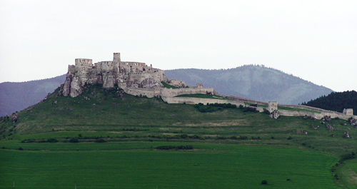
There are some tourist-favoured historical monuments located not far from Žilina. The Strečno Castle and the Lietava Castle are situated in city’s close vicinity. The Budatín Castle with a permanent exposition of wire artefacts and history of Považie and Žilina region is located in the city suburbs.